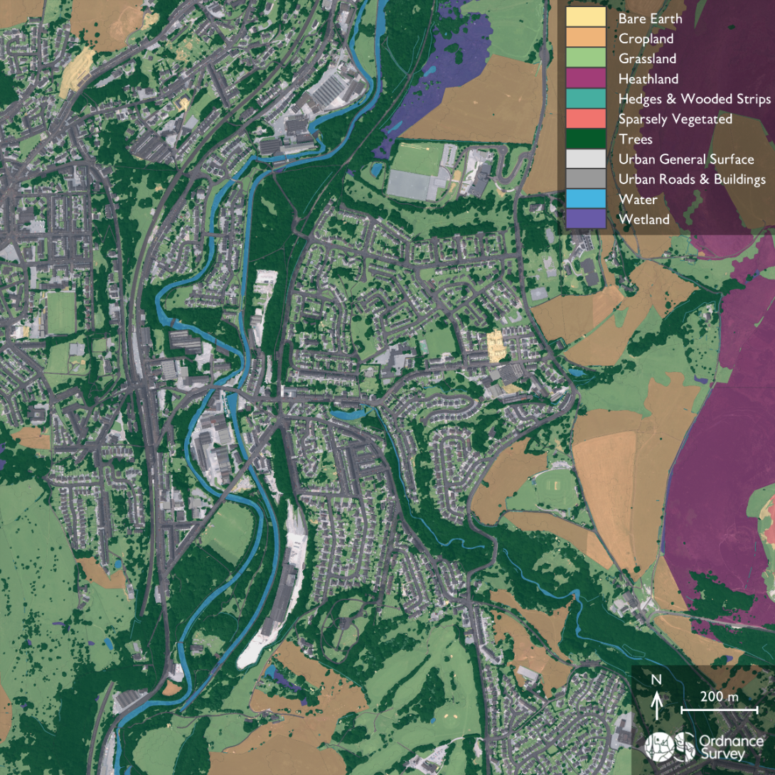
Picture courtesy of Ordnance Survey: An example of the land cover classifications available
Ordnance Survey (OS) has developed a new land and habitat data tool to help with Biodiversity Net Gain.
The tool could be used by rural and urban developers in England to support their target of providing a ten per cent Biodiversity Net Gain (BNG).
BNG legislation from Defra means that as part of planning applications, land and property developers must assess baseline habitats using Defra’s biodiversity metric, submit a biodiversity gain plan, deliver ten per cent gains on- or offsite through credits, and maintain and monitor habitats for 30 years. Defra has confirmed that BNG will become mandatory for Nationally Significant Infrastructure Projects from this November.
The new tool, OS Enhanced Land Cover (ELC) Beta provides a tool to support the new BNG challenges. It is a foundational dataset combining topography and land cover from the OS National Geographic Database, OS aerial imagery and OS terrain 5 with a range of third- party open habitat data. This includes information from Natural England’s Living England, the Rural Payments Agency’s Crop Map of England and UKHab’s classification system.
The tool can also be used to conduct BNG assessments – both for early workflow desktop analysis and for use by ecologists in the field. Developers, landowners, and ecologists can also better understand the composition of their land cover at scale before conducting more detailed surveys.
Wessex Water has already used OS ELC data to understand the biodiversity of hundreds of sites in one spatial picture and apply this data to their 30-year projections for BNG.