Image Copyright Ordnance Survey
Ordnance Survey has released new data on cycle lanes, which will help local authorities to support active travel.
The data shows users where cycle lane infrastructure is located, along with other information, such as direction of travel, modal width and minimum width, and where they link to associated roads or paths.
The cycle lane descriptions have been aligned to government guidance on cycle infrastructure design where possible.
Ordnance Survey has released partial coverage data, rather than waiting for all of GB to be complete. From September last year, the coverage is being increased on a month-by-month basis to full GB coverage by the end of March this year.
It is expected that local authorities will be the main users of the data. They will use it for asset management, understanding the length and width of current lanes, and connectivity. They can use the data to infill infrastructure and plan safer cycle routes.
The data will also be available to Active Travel England, the Department for Transport, and Transport Wales to support road safety analysis, measure policy success and support national cycling statistics.
The data has mostly been created using aerial imagery, captures sections of roads or paths that are designated for cyclists, either segregated by a physical feature, or identified by painted or other signage, or by a different colour of tarmac or surface type.
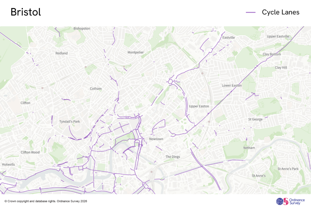
OS has analysed cycle lane data in Bristol and Edinburgh, both known for their cycling culture and infrastructure. OS has captured a total of 62 miles of cycle lanes in the City of Bristol, which equates to roughly 6 per cent of the road network in the city. Approximately 15 miles of these cycle lanes are advisory lanes (designated by a broken white line on the road carriageway), while two miles are fully segregated from the road carriageway. These insights can support analysis of where more segregated cycle infrastructure could be implemented to provide continuous physical segregation from traffic to improve safety. In the City of Edinburgh, OS has captured 113 miles of cycle lanes. This is approximately 8 per cent of the 1,447 miles of road network in the city.
Dean Paulley, head of data products at Ordnance Survey, said: “Encouraging more people to walk, wheel and cycle is vital for healthier communities and greener travel. Ordnance Survey’s new cycle lane data gives local authorities the insight they need to plan and manage safer, better-connected routes – helping make active travel the easy choice.”